Mô tả sản phẩm:
Molas 3D là một lidar đo gió Doppler tiên tiến hoạt động bằng công nghệ quét ba chiều. Nó dựa trên nguyên tắc biến tần Doppler liên kết bằng laser xung,cho phép phát hiện chính xác các đặc điểm gió.
Hệ thống này hỗ trợ nhiều chế độ quét bao gồm P-Pl, RHl, DBS và quét chương trình.
Molas 3D phù hợp với một loạt các ứng dụng. Nó có thể được sử dụng để đánh giá tài nguyên gió ngoài khơi, nghiên cứu trong môi trường địa hình phức tạp và phát hiện hiệu ứng sóng tuabin gió.Ngoài ra, nó đóng một vai trò quan trọng trong cảnh báo cắt gió đường trượt sân bay, quan sát khí tượng đô thị và phát hiện nhiễu loạn ở độ cao cao.
Đặc điểm:
Khả năng đo toàn diện:Hệ thống này cung cấp các phép đo trường gió 3D chi tiết với tối đa 300 lớp khoảng cách có thể tùy chỉnh, đảm bảo thu thập dữ liệu tinh tế cao phù hợp với nhu cầu cụ thể.
Phạm vi phát hiện rộng:Được trang bị để phát hiện mục tiêu ở khoảng cách 10 km ở độ cao dưới 600 mét, nó cung cấp một phạm vi rộng để phát hiện tầm nhìn chính xác.
Độ chính xác đặc biệt:Với độ chính xác chỉ 0,005 ° và độ chính xác tốc độ gió theo hướng thị giác 0,1 mét mỗi giây, nó đảm bảo các phép đo rất đáng tin cậy và chính xác.
Các kỹ thuật quét khác nhau:Hỗ trợ nhiều phương pháp quét bao gồm PPI, RHI, DBS và chế độ quét tùy ý có thể lập trình, cung cấp tính linh hoạt trong việc thu thập dữ liệu.
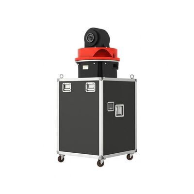
Thiết kế linh hoạt và nhẹ:Cấu trúc nhỏ gọn và nhẹ của nó cho phép triển khai dễ dàng và thích nghi nhanh chóng với các môi trường hoạt động khác nhau.
Sức bền trong mọi điều kiện thời tiết:Được xây dựng để chịu được môi trường ngoài trời khắc nghiệt, nó có khả năng sống sót trong LPZ0 và bao gồm bảo vệ sét, đảm bảo hiệu suất nhất quán bất kể thời tiết.
Hoạt động an toàn:Bao gồm báo cáo vị trí GPS và khả năng bao vây địa lý cùng với các biện pháp mã hóa dữ liệu để ngăn ngừa bất kỳ rủi ro rò rỉ thông tin nào.
Nhiều tùy chọn cấu hình:Cung cấp bốn độ phân giải khoảng cách khác nhau và năm thời gian tích lũy có thể chọn, cho phép cài đặt tùy chỉnh để đáp ứng các yêu cầu hoạt động đa dạng.
Các thông số kỹ thuật:
| Khoảng cách phát hiện tầm nhìn |
10 km |
| Chọn chính xác |
± 0,005° |
| Khoảng cách thu thập tối đa |
15 km |
| Trọng lượng |
≤ 100 kg |
| Khoảng cách đo dọc |
4 km |
| Dùng dữ liệu |
Profibus DP / Modbus TCP / CAN Tùy chọn |
| Thời gian tích lũy |
0.2 ~ 10 s Tùy chọn |
| Phạm vi tốc độ gió tầm nhìn |
-75 ~ +75 m/s |
| Phạm vi dọc |
-10 ~ 190° |
| Phương pháp quét |
PPI, RHI, DBS và Program Scan |
Sản phẩm lidar gió Doppler trên mặt đất này được thiết kế để đo lường lidar chính xác và lý tưởng cho các ứng dụng lidar gió trên đất liền.
Ứng dụng:
Đánh giá nguồn lực gió
Thực hiện đánh giá toàn diện về nguồn gió bao gồm việc đo dữ liệu trường gió trên các khu vực rộng lớn.
Quá trình này giúp giảm thiểu rủi ro liên quan đến việc lựa chọn địa điểm cho các dự án năng lượng gió.
Các phép đo đường cong công suất đường dài và phân tích dòng điện xoáy được sử dụng để tăng cường việc sử dụng hiệu quả năng lượng gió.
Các phương pháp này góp phần tối ưu hóa hiệu suất và hiệu quả của các đơn vị năng lượng gió.
Phát hiện và cảnh báo sớm các hiện tượng khí tượng nguy hiểm
Các hệ thống phát hiện tiên tiến cho phép cảnh báo sớm về các sự kiện thời tiết nguy hiểm như cắt gió và vi sóng.
Những hiểu biết này rất quan trọng đối với an toàn, đặc biệt là trong ngành hàng không và các lĩnh vực dễ bị tổn thương khác.
Việc đo đạc các xoáy sóng là điều cần thiết để tối ưu hóa sự tách biệt chuyến bay tại các sân bay, do đó cải thiện quản lý và an toàn giao thông hàng không.
Thông tin trường gió và quan sát ở độ cao thấp
Cung cấp thông tin chi tiết về trường gió là rất quan trọng để hiểu động lực bên trong lớp ranh giới khí quyển.
Dữ liệu hồ sơ gió không gian thời gian chính xác và độ phân giải cao trong vòng vài km từ bề mặt giải quyết các khoảng trống hiện có trong các quan sát khí tượng ở độ cao thấp.
Theo dõi phân tán sương mù 3D thời gian thực
Thông tin ba chiều thời gian thực về các hỗ trợ phân tán phấn trong việc theo dõi các nguồn phát thải hiệu quả.
Khả năng này đặc biệt có giá trị cho việc tối ưu hóa các chiến lược kiểm soát phát thải bụi trong ngành khai thác mỏ, tăng cường quản lý môi trường và tuân thủ.